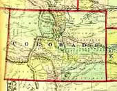
Colorado Map Index
Originally compiled by Lee Zion
Scanned Colorado Maps:
USGenWeb Digital Map Collection Colorado
County Maps
- Colorado Counties 1895
- Colorado Counties Circa 1905
- Colorado Counties 1920
- Huerfano County 1885 Also deplicts Custer, Fremont, Pueblo, Costilla and parts of the surrounding counties.
- Larimer County Map History
- Ouray County 1891 Red Mountain Mining District
- Yuma County 1922 From the Standard Atlas of Yuma County Colorado
- Coal Mines of Southern Colorado
City Maps
- 1881 Bird's Eye View of the City of Denver, Colorado
- 1872 Map of the Mountain Valley and Pleasure Grounds at Manitou Near Colorado Springs
Links to other Colorado Maps
Colorado County Map (source Wikipedia open source images)
Library of Congress: American Memories Map Collection
University of Texas at Austin: Historical Maps of the United States -The Perry-Castañeda Library Map Collection
- US Territorial Maps - 1775 , 1790 , 1800 , 1810 , 1820 , 1830 , 1840 , 1850 , 1860 , 1870 , 1880 , 1900 , 1920
- Bents Old Fort - US Park Service Schematic/Map
- Boulder - 1920 City Map
- Colorado Springs - 1920 City Map
- Denver - 1920 City Map
-
Pueblo - 1920 City Map
- Colorado County Evolution - This map series shows Colorado County borders from 1860 to 2001.
- 1879 Railroad Map
1895 U.S. Atlas - Colorado
Index.
These are well detailed maps with the USGenWeb Archives
Ray Steiner
Color Landform Atlas of the U.S. Colorado Index
These pages are now maintained by Rebecca Maloney. If you have an old Colorado Map that could be scanned for this project or have a link to a Colorado Map that is already on the WWW please send her an email message.
Return to the COGenWeb Main Page

