| Range Township/Land Survey Map | ||
|---|---|---|
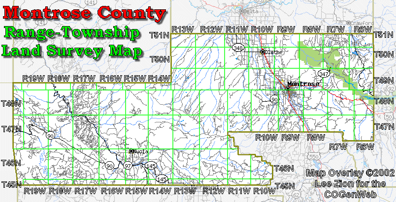
| Montrose County is
another county that was surveyed under the New Mexico Principal
Meridian. Townships are numbered North of the Baseline which is
about 290 miles south of Montrose. Ranges are numbered West of the
Meridian which runs through the city of Gunnison.
The extreme southwestern corner of the county was not included in the survey grid. None of the Montrose County borders are defined by the township lines so all the townships along the borders are shared with neighboring counties.
|
||
|
|
||
|