 | Welcome to COGenWeb Digital Map Collection |
 |
Larimer County Borders?
Originally compiled by Lee Zion
Larimer County's western border was not firmly defined until 1886. That has lead to much confusion on the part of cartographers and Jackson County historians.
See the following contemporary maps:
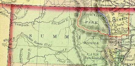
Northwest Colorado 1861-1874. This map is a detail from Colorado Territory - 1872 with overlay (red and blue lines) to show the disputed boundary.
A description of the 1861 Act creating the counties in the new Colorado Territory is presented on page 15 of the Historical Atlas of Colorado, University of Oklahoma Press, ©1993. It reads (in part):
[quote] ... In shaping the seventeen original counties, the
legislators had two problems. First they had to describe boundaries in a
territory that had just begun to be surveyed in the east and remained largely
unexplored in the west. ....
..... The western boundary of Larimer County
was described as the Snowy Range without clarifying whether that meant
the continental divide or the crest of the Medicine Bow Range. When valuable
minerals were discovered in North Park, both Larimer County and Grand County
claimed the area. In 1886 the Colorado Supreme Court declared the disputed
land a part of Larimer County. ....
On the 1872 map (above), the red line is the Larimer County boundary set by the 1886 Supreme Court decision. The blue line is the crest of the Medicine Bow Range which had (mostly) been the accepted western boundary of Larimer County until 1886. The disputed area between the two lines (North Park) became Jackson County on May 5, 1909.
Depending on the source of the information, North Park belonged to Summit, Grand and Larimer Counties or just to Larimer County prior to 1909. This can complicate your family research!
Most (if not all) contemporary (1861-1886) cartographers fixed the Larimer County western boundary as the crest of the Medicine Bow Range.
More Map Examples:
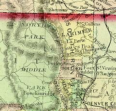
1872 Colorado Territory Map (Detail of Eastern Summit, Boulder and Larimer Counties). Extracted from a large 1872 map of Colorado Territory. (Above map without overlay.)
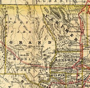
1879 Colorado (Grand, Boulder and Larimer Counties). Detail from a Rand McNally Railroad Map of Coloradopublished in 1879.
1881 Colorado

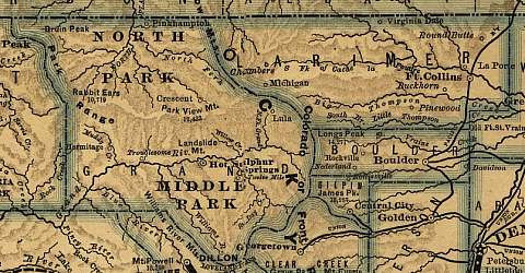
1886 Colorado (Eastern Routt, Grand, Boulder and Larimer Counties) Detail from a 1886 Denver and Rio Grand Railroad System Map. Note: This map was drawn prior to the 1886 Colorado Supreme Court decision.
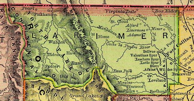
1895 Colorado (Larimer County). Detail from a Rand McNally Atlas of the United States published in 1895. Note: This map was drawn after the Colorado Supreme Court decision.
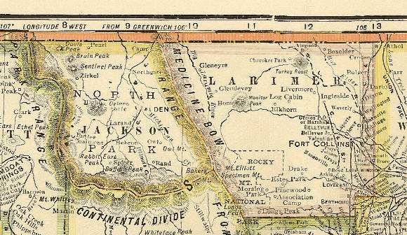
1920 Colorado Detail (Jackson and Larimer Counties) from a 1920 Map of Colorado published in the Standard Atlas of Yuma County. This map shows Larimer County's boundary, along the Medicine Bow Range again, after Jackson County was created in 1909.
Return to the COGenWeb Main Page