.jpg)
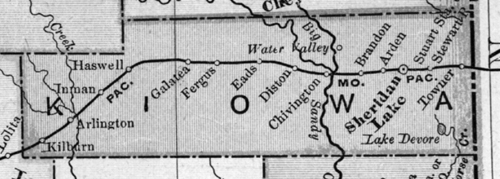
1898 Kiowa County Map
Maps, Atlases and Gazetteers
- Colorado Digital Map Library
- - Maps from 1905, 1920, link to 1872 & 1895 maps.
- Colorado County Evolution
- - Pictorial depiction of the evolution of the counties of Colorado.
- - From the US Census Bureau
USGS GNIS Database
- USGS GNIS Place Locator
- - Use the USGS GNIS data base to find the location of towns, cemeteries or other geographical features.