|
|
|
|---|---|
|
|
|
|
|
|
|
GARFIELD COUNTY, COGENWEB PROJECT |
|
|
|
|
MAPS |
|
|
Thumbnail |
Description (Click on thumbnails to see a larger image) |
|
|
1885 map from Crofutt's Grip-Sack Guide |
| 1888 |
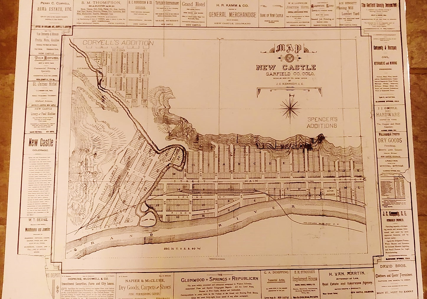
Circa 1888 - Map of New Castle. Due to the size of this map it is difficult to
get the clarity from this post to truly show the amazing historic value it
contains. This is a copy of the earliest known map of the town, it includes the
Coryell Addition which was not part of the town at the time and commonly
referred to as Coryell Town (the Coryell Addition was platted in 1887). The map
also shows the original flow of Elk Creek. West of Elk Creek you can see lots
and blocks platted where the rail lines that fed the Consolidated Mine were
located (Elk Creek Elementary School located there today). What makes the map
very special are the early business advertisements around the border of the map.
These are the earliest businesses in New Castle as well as some from Glenwood
Springs. I (Steve Rippy) believe this map was put together for the marketing of
the new town. Approximately 25 years ago, while serving as the town's Mayor, I came across a box that had the pieces of this map in the Town's vault. The pieces were only a copy of the original, I was not able to find the original map and was certain the original was long gone. I spent the next several weeks using tape and white-out to put the map back together and had a copy made which is reflected here. |
|
|
Map from an 1895 Atlas (56kb) |
|
|
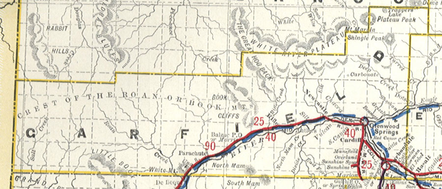
1899 Railroad Map for Garfield County |
|
|
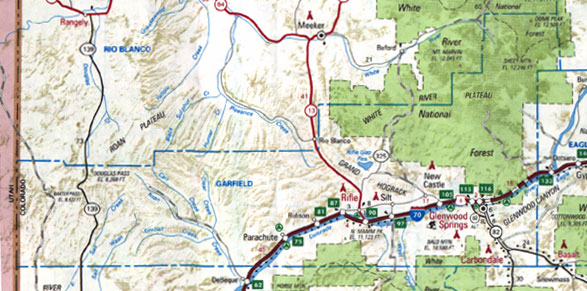
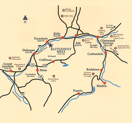
Modern road map (75kb) |
|
|
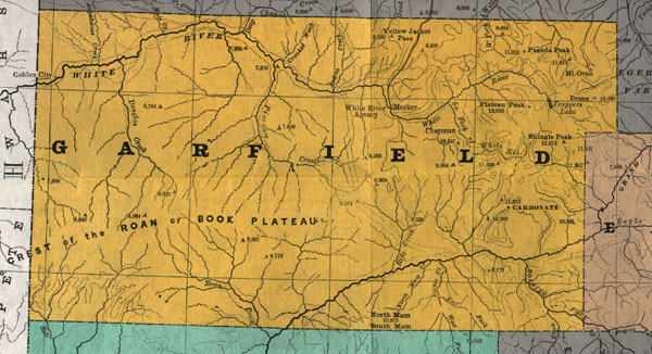
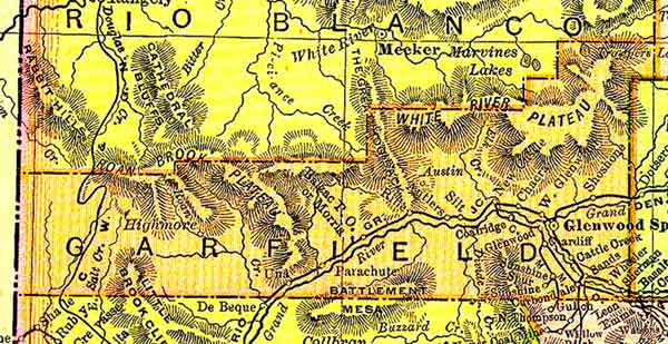
Modern Garfield Map |
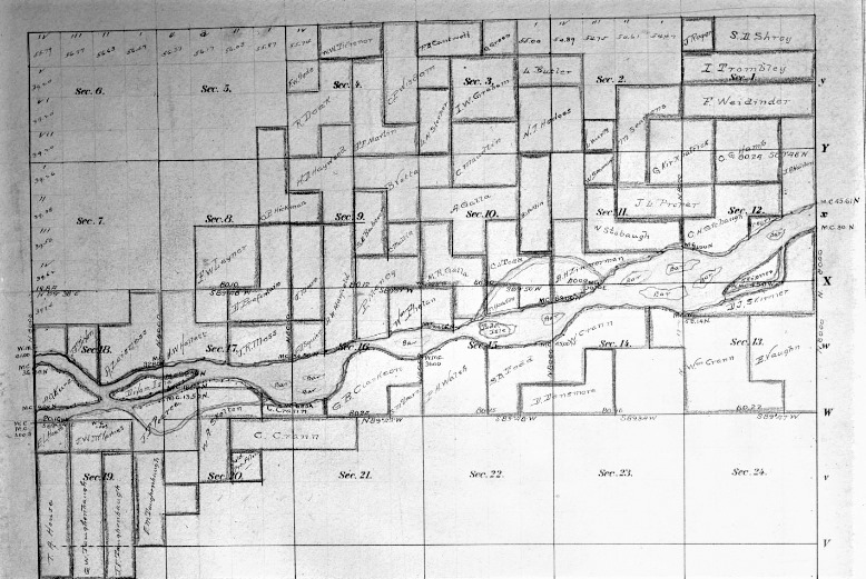 |
Homestead Plats Garfield County Colorado |
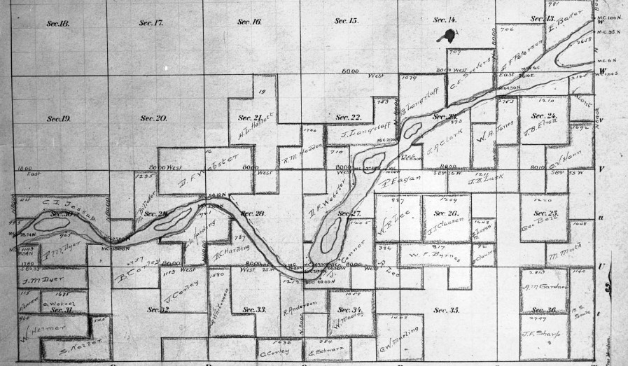 |
Homestead Plats Garfield County Colorado |
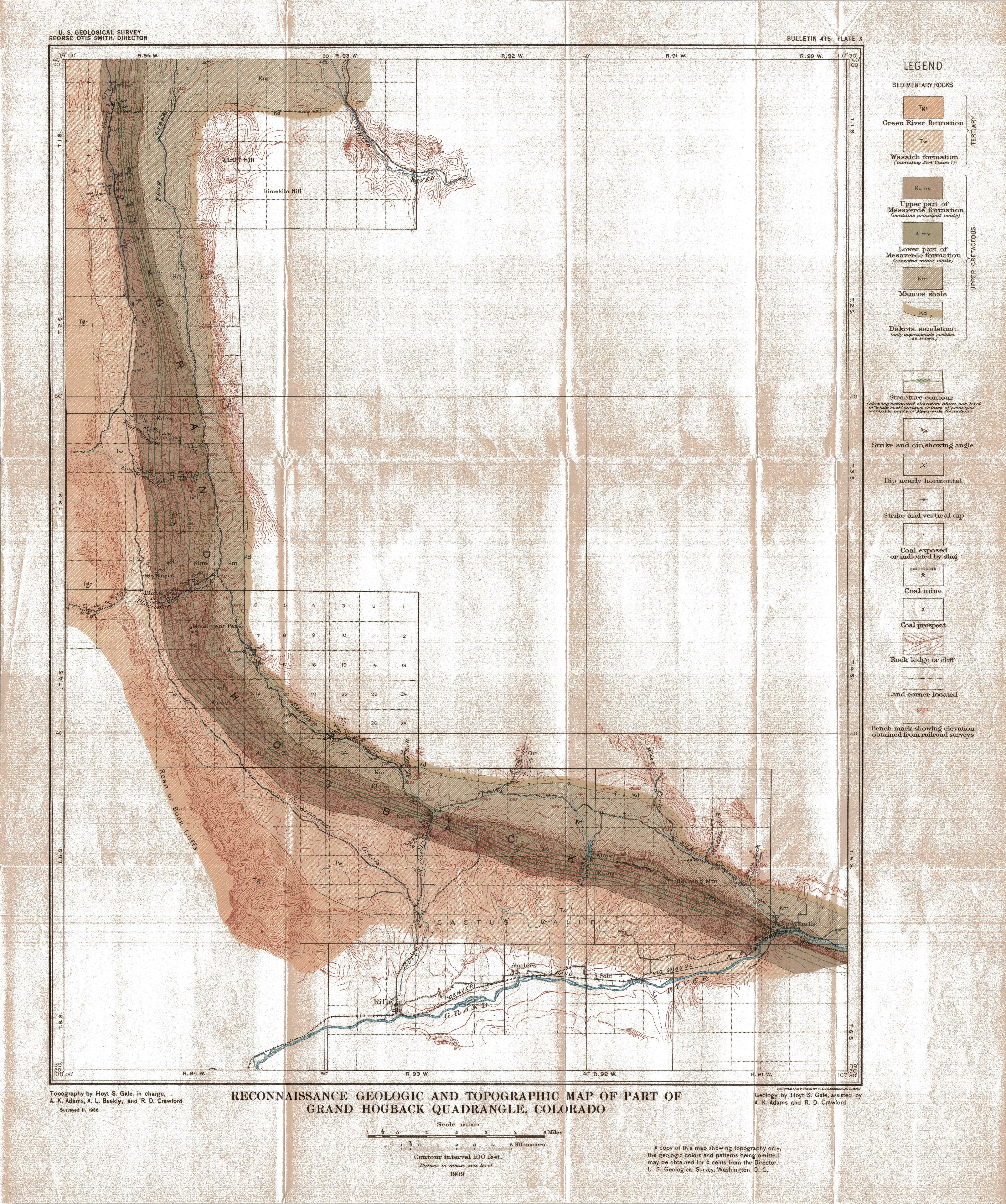 |
1909 topo map of the Hogback with coal resources overlaid. See the legend on the
right side. X's are coal prospects. Crossed picks are mines. The green lines are the elevation from sea level of the top of the principle coal bed. |
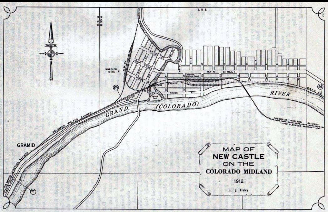 |
1912 map of New Castle, by the Colorado Midland Railroad. Six years later, CMRR
was bankrupt and shut down. They were a casualty of government mismanagement of rail traffic while taken over for WWI. The CMRR was denied freight, it all went on the D&RG. |
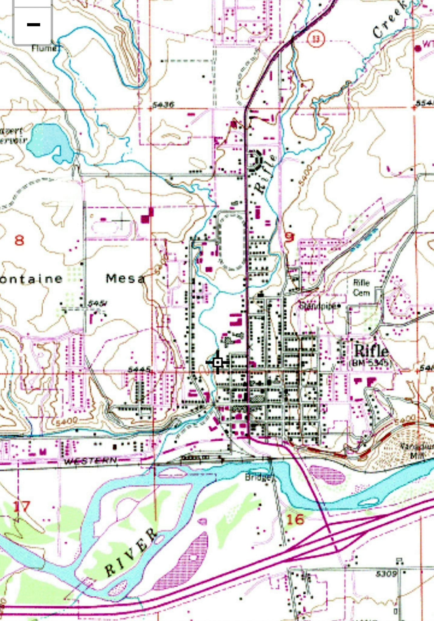 |
The black data is from 1952, all field checked. Purple is a 1982 revision from 1979 photos, not field checked |
|
|
|
|
© Copyrighted 1998 to by Vikki Gray for the benefit of the COGenWeb Project, all rights reserved. Should you feel like helping out in COGenWeb Project please contact the State Coordinator or Assistant State Coordinator by visiting the main website for the
|
|