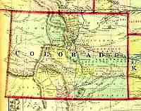
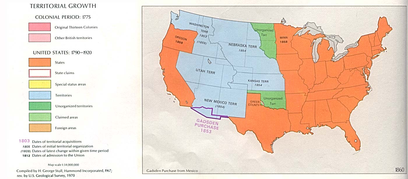
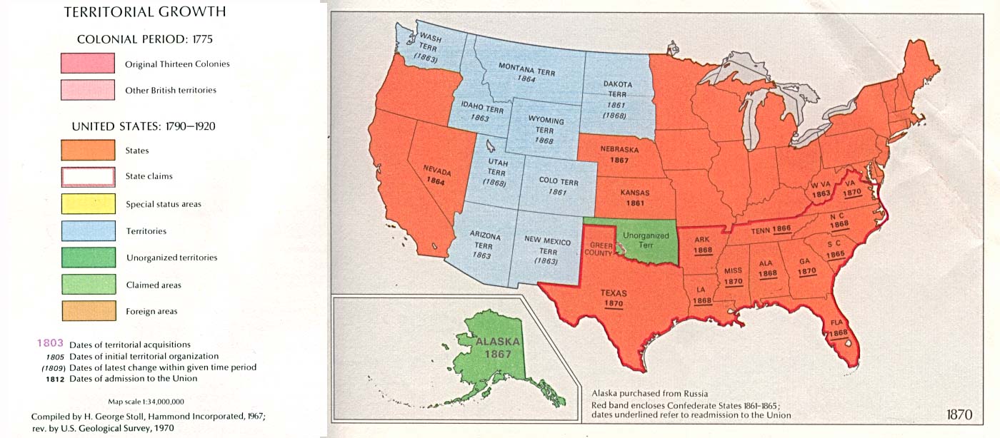
Colorado Territory 1872
Reduced version of the
large map
Scanned by Pam Rietsch
Used with her permission.
Library of Congress - American Memories Map Collection
University of Texas at Austin -
Historical Maps
of the United States - The Perry-Castañeda
Library Map Collection
Don Stanwyck's COGenWeb Maps -
Colorado County
Evolution
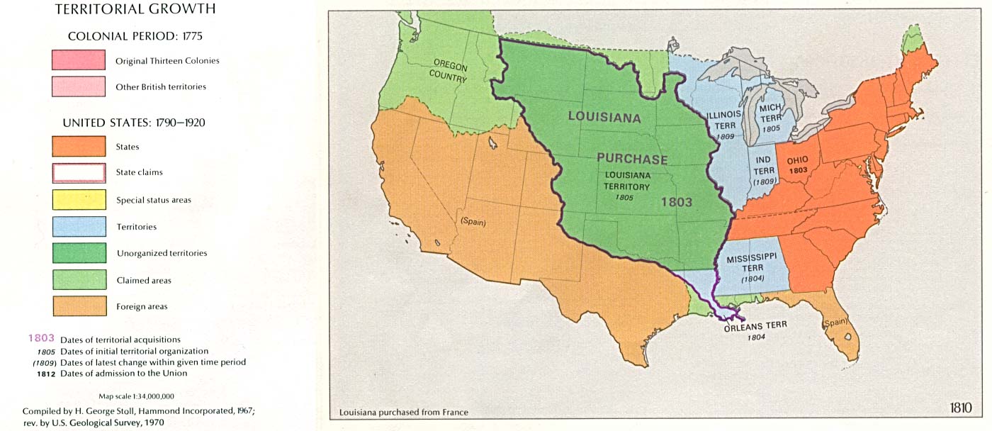
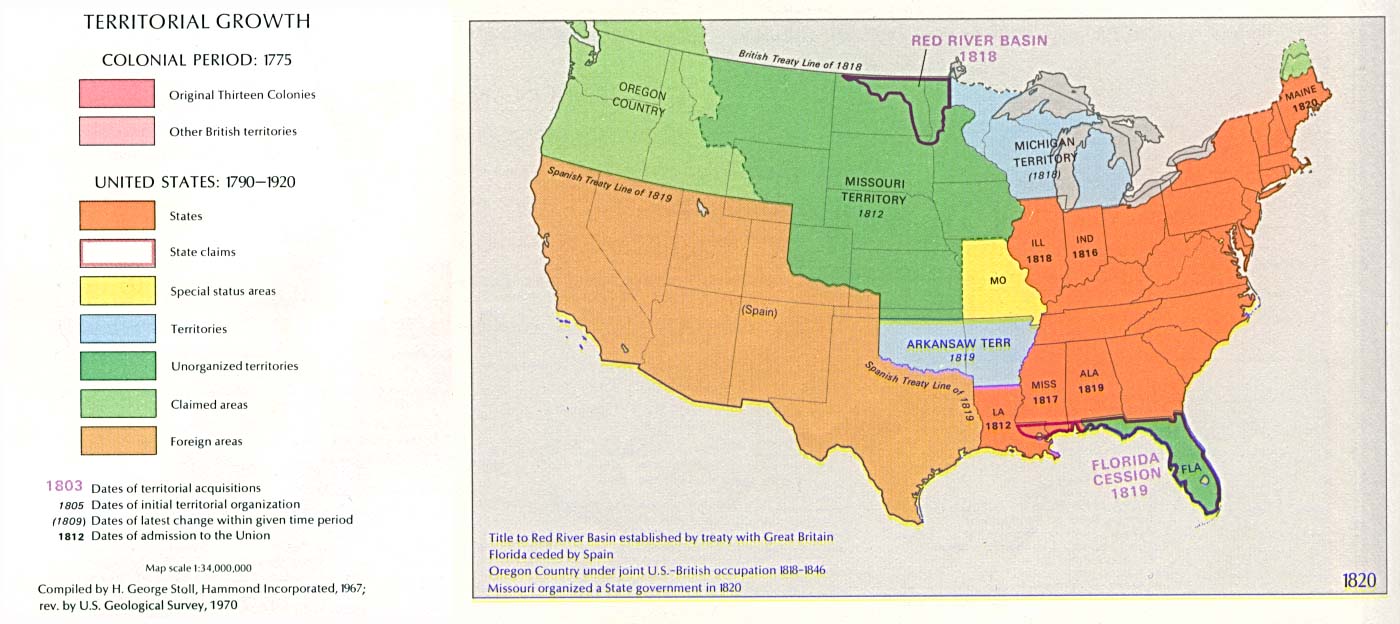
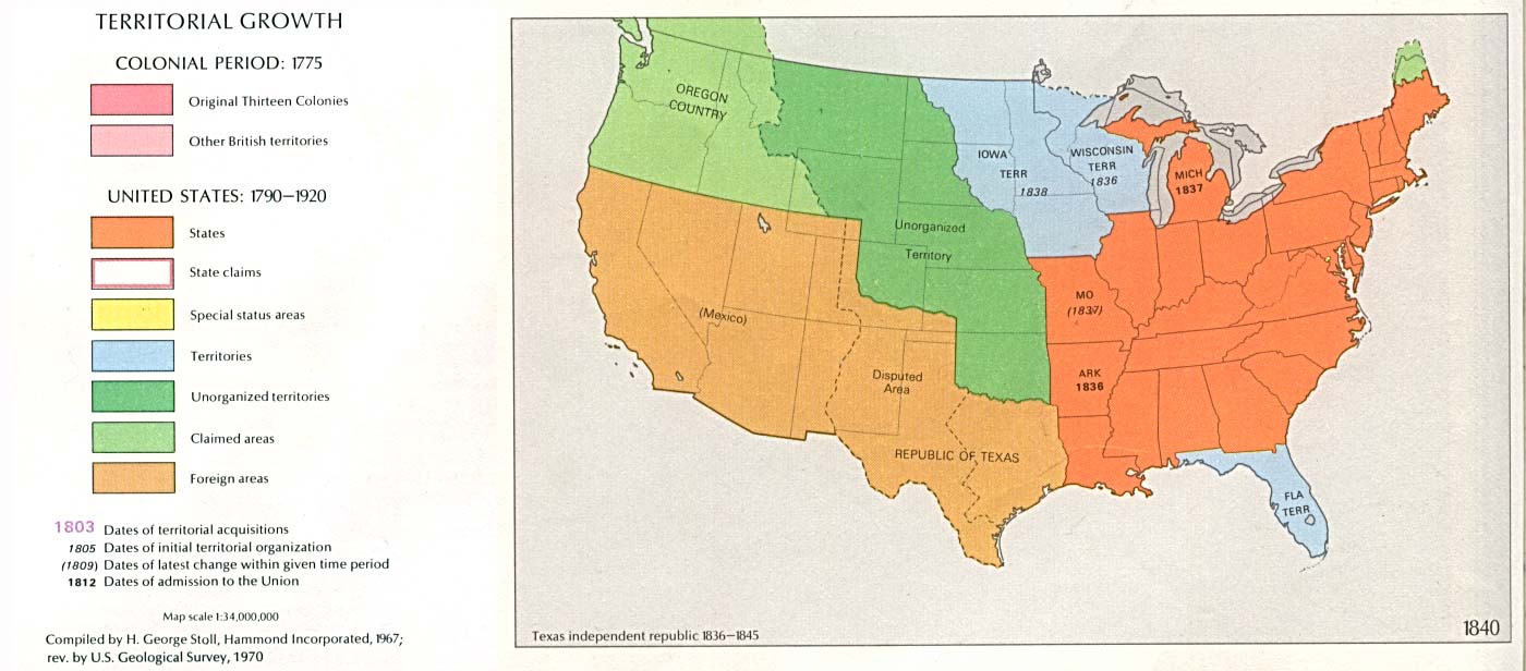
This map series shows Colorado County borders from
1860 to 2001.
Pam Rietsch's Livingston County, Mich. GenWeb Page -
1895 U.S. Atlas - Colorado
Index
These are huge, well detailed maps with the transcribed
Gazetteer. The 1895 Colorado Map is 1.7 MB. The Weld County Map is 860 MB.
Ray Steiner's Color Landform Atlas of the U.S.
Colorado Index
Back to COGenWeb's Colorado Places by County
If you have an old Colorado Map that could be scanned for this project or have a link to a Colorado Map that is already on the WWW please send an email message to Colleen Pustola.
Return to the Colorado GenWeb Main Page.